.
vessel XIN HAI IMO: 9406477, Bulk Carrier vesseltracker.com
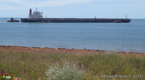
Vessel XIN HAI IMO: 9406477, MMSI: 636021720 Bulk Carrier

callsign: 5LFJ5
size: 50x300

Live AIS position: UTC. 30 nm SW of Fairview), updated 2026-01-17 19:22:06 UTC.

Find the position of the vessel XIN HAI on the map. The latter are known coordinates and path.

marine traffic ship tracker show on live map

The current position of vessel XIN HAI is -34.43352 lat / 23.81297 lng. Updated: 2026-01-17 19:22:06 UTC

Currently sailing under the flag of Liberia

XIN HAI built in 2007 year

Deadweight:
206331 t

Details:


Last coordinates of the vessel:
UTC, -34.39333, 24.23777, course: 258, speed: 10.9
UTC, -34.39585, 24.20863, course: 258, speed: 10.9
UTC, -34.41897, 23.98302, course: 257, speed: 10.7
2026-01-17 19:22:06 UTC, -34.43352, 23.81297, course: 258, speed: 11.3


Most frequent ports a vessels calls at XIN HAI (636021720):

Selat Lombok, traffic: 7
Samson Point, traffic: 4
Sekondi, traffic: 4
Takoradi, traffic: 4
Port Walcot, traffic: 4
Sambu, traffic: 4
CIWANDAN, traffic: 3
Sebang, traffic: 3
Taicang, traffic: 3
Singapore, traffic: 3
Wu-Sung, traffic: 3
Wusong, traffic: 3
Dampier, traffic: 2
Gladstone Harbor, traffic: 2
MERAK, traffic: 2

Link to the map:


Find another ship

XIN_HAI (636021720) last ports (portcalls and passsages)

Rizhao Pt | 2025-09-14 11:40:21
SURALAYA | 2025-09-02 02:24:47
MERAK | 2025-09-02 01:09:06
Selat Sunda | 2025-09-02 00:22:02
Sebang | 2025-06-22 19:10:04
Ta-Ku | 2025-06-06 04:23:05
Dagu Bar | 2025-06-06 02:58:33
Taku Bar | 2025-06-06 01:36:50
MERAK | 2025-05-25 04:13:25
Takoradi | 2025-04-20 08:16:54
Takoradi | 2025-04-16 08:05:32
Takoradi | 2025-04-12 07:21:07
Takoradi | 2025-04-08 06:57:07
PULAU SAMBU | 2025-03-08 14:41:31
TANAH MERAH | 2025-03-07 22:14:36
PENGERANG | 2025-03-07 19:25:19
Fangcheng | 2025-03-03 02:23:40
Fangcheng | 2025-02-27 01:15:48
SURALAYA | 2025-02-10 17:12:47
CIWANDAN | 2025-02-10 16:10:12
Cape Of Good Hope | 2024-12-16 22:38:55
Sebang | 2024-11-27 16:11:21
BUKOM ISLAND | 2024-11-25 15:43:18
BATU AMPAR | 2024-11-25 14:27:46
TANAH MERAH | 2024-11-24 14:19:54
PENGERANG | 2024-11-24 12:59:04
JINGTANG | 2024-11-11 19:06:12
Singapore | 2024-08-05 07:08:44
Jingjiang | 2024-07-27 07:59:58
Zhangjiagang | 2024-07-24 09:43:34
Nantong | 2024-07-24 06:58:42
Taicang | 2024-07-24 03:16:16
Wusong | 2024-07-23 06:06:41
Jingjiang | 2024-07-23 01:02:34
Sebang | 2024-04-23 01:40:06
Singapore | 2024-04-20 20:47:15
Selat Lombok | 2023-08-11 05:27:11
Samson Point | 2023-08-06 05:54:15
Bayuquan | 2023-07-18 20:30:34
Selat Lombok | 2023-07-03 14:04:22
Samson Point | 2023-06-28 16:01:37
Samson Point | 2023-06-24 14:29:14
Selat Lombok | 2023-06-21 21:15:25
Taicang | 2023-06-12 04:09:33
Wusong | 2023-06-08 20:05:30
Lianyungang | 2023-06-04 22:35:05
Selat Lombok | 2023-05-22 16:31:59
Samson Point | 2023-05-17 13:19:38
Selat Lombok | 2023-05-14 20:50:44
Taicang | 2023-05-02 23:37:26
Wusong | 2023-05-02 15:09:15
Selat Lombok | 2023-04-11 02:58:00
Dampier | 2023-02-23 08:28:38
Qingdao | 2023-02-06 05:35:29
Dampier | 2023-01-14 08:44:40
Selat Lombok | 2023-01-08 05:48:59
Yokkaichi | 2022-05-06 13:12:15
Nagoya | 2022-05-04 04:02:13
Yokkaichi | 2022-05-02 12:14:27
Oita | 2022-04-19 09:19:09
Gladstone Harbor | 2022-03-30 21:30:43
Sambu | 2022-02-06 15:00:07