 vesseltracker.com
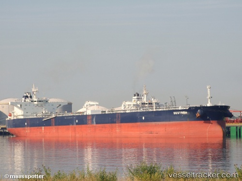
Vessel Sestrea IMO: 9406659, MMSI: 636015522 Crude Oil Tanker
UTC, 24.55886, -88.37588, course: 100, speed: 12.7
UTC, 24.46384, -87.86784, course: 104, speed: 12.9
2026-01-17 13:38:31 UTC, 24.45381, -87.82170, course: 104, speed: 13.1
Live AIS position:
UTC. 158 nm E of Munshiganj),
updated 2026-01-17 13:38:31 UTC.
Find the position of the vessel Sestrea on the map. The latter are known coordinates and path.
marine traffic ship tracker show on live map
The current position of vessel Sestrea is 24.45381 lat / -87.82170 lng. Updated: 2026-01-17 13:38:31 UTCDetails:
Last coordinates of the vessel:
UTC, 24.65146, -88.80339, course: 105, speed: 13.2UTC, 24.55886, -88.37588, course: 100, speed: 12.7
UTC, 24.46384, -87.86784, course: 104, speed: 12.9
2026-01-17 13:38:31 UTC, 24.45381, -87.82170, course: 104, speed: 13.1