 vesseltracker.com
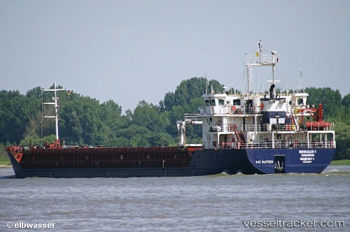
Vessel Dremora 1 IMO: 9407029, MMSI: 341654000 Multi Purpose Carrier
UTC, 45.24674, 36.53660, course: 84, speed: 54.8
UTC, 45.24674, 36.53660, course: 84, speed: 54.8
2026-01-18 15:58:49 UTC, 45.17907, 36.93974, course: 86, speed: 8.6
Live AIS position:
UTC. Near Taman),
updated 2026-01-18 15:58:49 UTC.
Find the position of the vessel Dremora 1 on the map. The latter are known coordinates and path.
marine traffic ship tracker show on live map
The current position of vessel Dremora 1 is 45.17907 lat / 36.93974 lng. Updated: 2026-01-18 15:58:49 UTCCurrently sailing under the flag of Saint Kitts and Nevis
Details:
Last coordinates of the vessel:
UTC, 45.24530, 36.52949, course: 46, speed: 51.6UTC, 45.24674, 36.53660, course: 84, speed: 54.8
UTC, 45.24674, 36.53660, course: 84, speed: 54.8
2026-01-18 15:58:49 UTC, 45.17907, 36.93974, course: 86, speed: 8.6