 vesseltracker.com
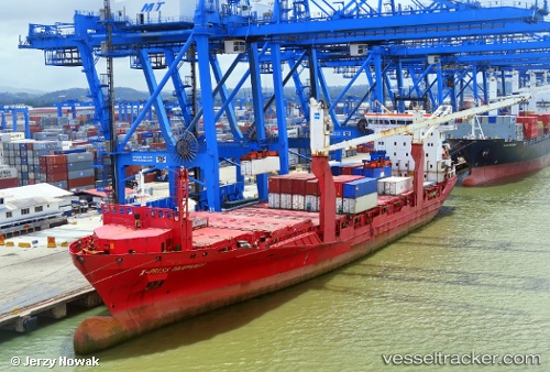
Vessel Orinoco IMO: 9412476, MMSI: 564050000 Container Ship
UTC, 21.38553, -171.81177, course: 109, speed: 15.2
UTC, 21.31331, -171.59641, course: 110, speed: 14.7
2026-01-15 00:07:01 UTC, 20.93962, -170.41939, course: 110, speed: 15.3
Live AIS position:
UTC. 258 nm N of Johnston Island),
updated 2026-01-15 00:07:01 UTC.
Find the position of the vessel Orinoco on the map. The latter are known coordinates and path.
marine traffic ship tracker show on live map
The current position of vessel Orinoco is 20.93962 lat / -170.41939 lng. Updated: 2026-01-15 00:07:01 UTCCurrently sailing under the flag of Singapore
Orinoco built in 2010 year
Deadweight:
12306 tDetails:
Last coordinates of the vessel:
UTC, 21.40240, -171.87054, course: 106, speed: 15.2UTC, 21.38553, -171.81177, course: 109, speed: 15.2
UTC, 21.31331, -171.59641, course: 110, speed: 14.7
2026-01-15 00:07:01 UTC, 20.93962, -170.41939, course: 110, speed: 15.3