 vesseltracker.com
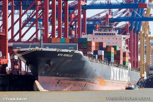
Vessel Nyk Romulus IMO: 9416989, MMSI: 563079000 Container Ship
UTC, 45.37326, -14.78172, course: 238, speed: 17.8
UTC, 45.26982, -15.01533, course: 239, speed: 17.7
2026-01-18 13:32:06 UTC, 45.26982, -15.01533, course: 239, speed: 17.7
Live AIS position:
UTC. 137 nm E of Drenje),
updated 2026-01-18 13:32:06 UTC.
Find the position of the vessel Nyk Romulus on the map. The latter are known coordinates and path.
marine traffic ship tracker show on live map
The current position of vessel Nyk Romulus is 45.26982 lat / -15.01533 lng. Updated: 2026-01-18 13:32:06 UTCCurrently sailing under the flag of Singapore
Nyk Romulus built in 2010 year
Deadweight:
65883 tDetails:
Last coordinates of the vessel:
UTC, 45.37326, -14.78172, course: 238, speed: 17.8UTC, 45.37326, -14.78172, course: 238, speed: 17.8
UTC, 45.26982, -15.01533, course: 239, speed: 17.7
2026-01-18 13:32:06 UTC, 45.26982, -15.01533, course: 239, speed: 17.7