 vesseltracker.com
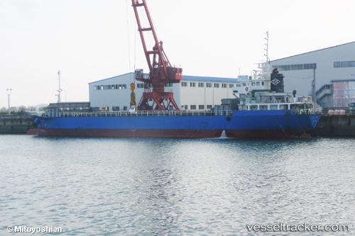
Vessel Hoju IMO: 9424352, MMSI: 431000355 General Cargo Ship
UTC, 34.24793, 133.54822, course: 179, speed: 9.6
UTC, 34.02222, 133.53281, course: 254, speed: 0.2
2026-01-16 15:46:13 UTC, 34.02252, 133.53163, course: 123, speed: 0
Live AIS position:
UTC. Near Shikokuchuo),
updated 2026-01-16 15:46:13 UTC.
Find the position of the vessel Hoju on the map. The latter are known coordinates and path.
marine traffic ship tracker show on live map
The current position of vessel Hoju is 34.02252 lat / 133.53163 lng. Updated: 2026-01-16 15:46:13 UTCDetails:
Last coordinates of the vessel:
UTC, 34.28255, 133.58115, course: 232, speed: 9.5UTC, 34.24793, 133.54822, course: 179, speed: 9.6
UTC, 34.02222, 133.53281, course: 254, speed: 0.2
2026-01-16 15:46:13 UTC, 34.02252, 133.53163, course: 123, speed: 0