 vesseltracker.com
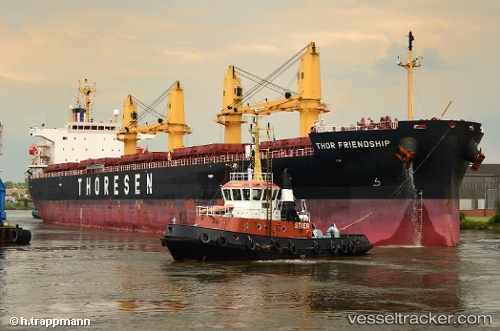
Vessel Thor Friendship IMO: 9424601, MMSI: 565155000 Bulk Carrier
UTC, 26.07635, 55.92830, course: 268, speed: 0.1
UTC, 26.07555, 55.92818, course: 296, speed: 0.1
2026-01-18 20:38:45 UTC, 26.07514, 55.92758, course: 312, speed: 0
Live AIS position:
UTC. Near Hulaylah Terminal),
updated 2026-01-18 20:38:45 UTC.
Find the position of the vessel Thor Friendship on the map. The latter are known coordinates and path.
marine traffic ship tracker show on live map
The current position of vessel Thor Friendship is 26.07514 lat / 55.92758 lng. Updated: 2026-01-18 20:38:45 UTCDetails:
Last coordinates of the vessel:
UTC, 26.07673, 55.92831, course: 249, speed: 0.1UTC, 26.07635, 55.92830, course: 268, speed: 0.1
UTC, 26.07555, 55.92818, course: 296, speed: 0.1
2026-01-18 20:38:45 UTC, 26.07514, 55.92758, course: 312, speed: 0