 vesseltracker.com
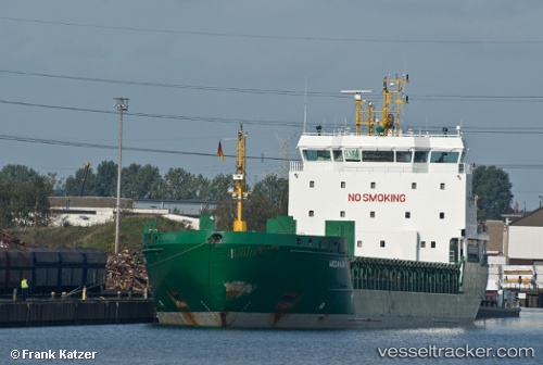
Vessel Halland IMO: 9436238, MMSI: 212536000 Multi Purpose Carrier
UTC, 60.52383, 27.17121, course: 345, speed: 0
UTC, 60.52382, 27.17109, course: 344, speed: 0
2026-01-18 13:51:32 UTC, 60.52381, 27.17122, course: 344, speed: 0
Live AIS position:
UTC. Near Lakulahti),
updated 2026-01-18 13:51:32 UTC.
Find the position of the vessel Halland on the map. The latter are known coordinates and path.
marine traffic ship tracker show on live map
The current position of vessel Halland is 60.52381 lat / 27.17122 lng. Updated: 2026-01-18 13:51:32 UTCCurrently sailing under the flag of Cyprus
Halland built in 2008 year
Deadweight:
6795 tDetails:
Last coordinates of the vessel:
UTC, 60.52381, 27.17120, course: 345, speed: 0UTC, 60.52383, 27.17121, course: 345, speed: 0
UTC, 60.52382, 27.17109, course: 344, speed: 0
2026-01-18 13:51:32 UTC, 60.52381, 27.17122, course: 344, speed: 0