 vesseltracker.com
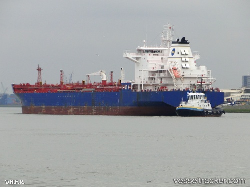
Vessel Costanza M IMO: 9436680, MMSI: 247258500 Chemical Oil Products Tanker
UTC, 46.08134, -8.08808, course: 208, speed: 12.6
UTC, 45.85390, -8.26548, course: 210, speed: 13.1
2026-01-18 18:14:38 UTC, 45.83857, -8.27720, course: 208, speed: 13
Live AIS position:
UTC. 36 nm S of Boboras),
updated 2026-01-18 18:14:38 UTC.
Find the position of the vessel Costanza M on the map. The latter are known coordinates and path.
marine traffic ship tracker show on live map
The current position of vessel Costanza M is 45.83857 lat / -8.27720 lng. Updated: 2026-01-18 18:14:38 UTCCurrently sailing under the flag of Italy
Costanza M built in 2009 year
Deadweight:
40042 tDetails:
Last coordinates of the vessel:
UTC, 46.24991, -7.96686, course: 210, speed: 12.7UTC, 46.08134, -8.08808, course: 208, speed: 12.6
UTC, 45.85390, -8.26548, course: 210, speed: 13.1
2026-01-18 18:14:38 UTC, 45.83857, -8.27720, course: 208, speed: 13