 vesseltracker.com
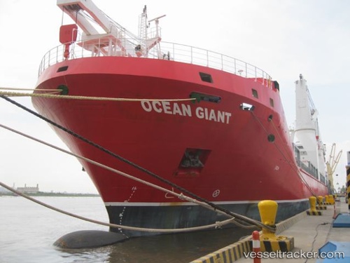
Vessel Ocean Giant IMO: 9437335, MMSI: 367535950 Heavy Load Carrier
UTC, 48.33979, -69.17180, course: 58, speed: 14.4
UTC, 48.51731, -68.81752, course: 58, speed: 15.5
2026-01-18 12:19:31 UTC, 48.82453, -68.10628, course: 57, speed: 15.2
Live AIS position:
UTC. 10 nm NW of Metis-sur-Mer),
updated 2026-01-18 12:19:31 UTC.
Find the position of the vessel Ocean Giant on the map. The latter are known coordinates and path.
marine traffic ship tracker show on live map
The current position of vessel Ocean Giant is 48.82453 lat / -68.10628 lng. Updated: 2026-01-18 12:19:31 UTCCurrently sailing under the flag of USA
Ocean Giant built in 2012 year
Deadweight:
18389 tDetails:
Last coordinates of the vessel:
UTC, 48.18473, -69.51589, course: 37, speed: 13.1UTC, 48.33979, -69.17180, course: 58, speed: 14.4
UTC, 48.51731, -68.81752, course: 58, speed: 15.5
2026-01-18 12:19:31 UTC, 48.82453, -68.10628, course: 57, speed: 15.2