 vesseltracker.com
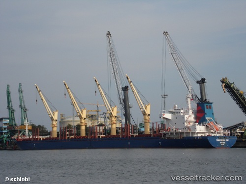
Vessel BOS BROOK IMO: 9437505, MMSI: 375278000 Bulk Carrier
UTC, 7.26667, 100.63167, course: -1, speed: 0
UTC, 7.26667, 100.63167, course: -1, speed: 0
2026-01-17 03:46:18 UTC, 7.26667, 100.63167, course: -1, speed: 0
Live AIS position:
UTC. 24 nm NE of Hat Yai International Apt),
updated 2026-01-17 03:46:18 UTC.
Find the position of the vessel BOS BROOK on the map. The latter are known coordinates and path.
marine traffic ship tracker show on live map
The current position of vessel BOS BROOK is 7.26667 lat / 100.63167 lng. Updated: 2026-01-17 03:46:18 UTCCurrently sailing under the flag of St Vincent and Grenadines
BOS BROOK built in 2010 year
Deadweight:
32688 tDetails:
Last coordinates of the vessel:
UTC, 7.26667, 100.63167, course: -1, speed: 0UTC, 7.26667, 100.63167, course: -1, speed: 0
UTC, 7.26667, 100.63167, course: -1, speed: 0
2026-01-17 03:46:18 UTC, 7.26667, 100.63167, course: -1, speed: 0