 vesseltracker.com
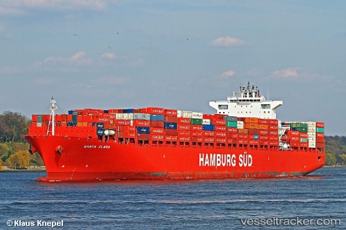
Vessel Santa Clara IMO: 9444716, MMSI: 219075000 Container Ship
UTC, 21.33081, 69.08314, course: 303, speed: 10.5
UTC, 21.52184, 68.75306, course: 325, speed: 0.9
2026-01-16 05:49:07 UTC, 21.51860, 68.74485, course: 314, speed: 1
Live AIS position:
UTC. 58 nm SW of Positra),
updated 2026-01-16 05:49:07 UTC.
Find the position of the vessel Santa Clara on the map. The latter are known coordinates and path.
marine traffic ship tracker show on live map
The current position of vessel Santa Clara is 21.51860 lat / 68.74485 lng. Updated: 2026-01-16 05:49:07 UTCCurrently sailing under the flag of Denmark
Santa Clara built in 2010 year
Deadweight:
93551 tDetails:
Last coordinates of the vessel:
UTC, 21.32158, 69.09991, course: 303, speed: 10.5UTC, 21.33081, 69.08314, course: 303, speed: 10.5
UTC, 21.52184, 68.75306, course: 325, speed: 0.9
2026-01-16 05:49:07 UTC, 21.51860, 68.74485, course: 314, speed: 1