 vesseltracker.com
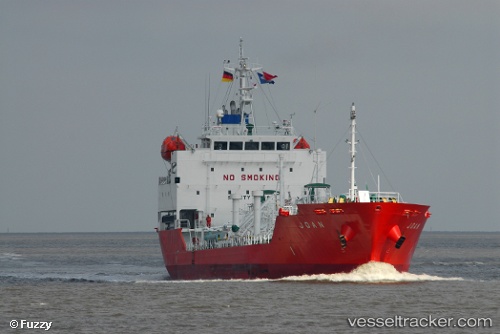
Vessel Joan IMO: 9448877, MMSI: 205771000 Lpg Tanker
UTC, 37.91615, -8.86553, course: 278, speed: 0.1
UTC, 37.91615, -8.86549, course: 287, speed: 0.2
2026-01-17 15:25:42 UTC, 37.91622, -8.86556, course: 275, speed: 0
Live AIS position:
UTC. Near Vila Nova de Santo André),
updated 2026-01-17 15:25:42 UTC.
Find the position of the vessel Joan on the map. The latter are known coordinates and path.
marine traffic ship tracker show on live map
The current position of vessel Joan is 37.91622 lat / -8.86556 lng. Updated: 2026-01-17 15:25:42 UTCCurrently sailing under the flag of Belgium
Joan built in 2009 year
Deadweight:
4000 tDetails:
Last coordinates of the vessel:
UTC, 37.91613, -8.86560, course: 295, speed: 0.2UTC, 37.91615, -8.86553, course: 278, speed: 0.1
UTC, 37.91615, -8.86549, course: 287, speed: 0.2
2026-01-17 15:25:42 UTC, 37.91622, -8.86556, course: 275, speed: 0