 vesseltracker.com
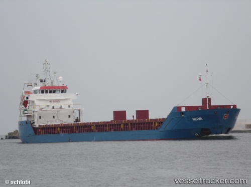
Vessel KILLU IMO: 9454826, MMSI: 304625000 General Cargo
UTC, 50.09991, -2.40794, course: 282, speed: 9.1
UTC, 50.27706, -2.80660, course: 289, speed: 7.9
2026-02-09 11:34:46 UTC, 50.34192, -3.05263, course: 284, speed: 7.8
Live AIS position:
UTC. 16 nm E of Brixham),
updated 2026-02-09 11:34:46 UTC.
ex EILEEN C
ex MMSI: 255806442
Find the position of the vessel KILLU on the map. The latter are known coordinates and path.
marine traffic ship tracker show on live map
The current position of vessel KILLU is 50.34192 lat / -3.05263 lng. Updated: 2026-02-09 11:34:46 UTCCurrently sailing under the flag of Antigua Barbuda
KILLU built in 2009 year
Deadweight:
6050 tDetails:
ex EILEEN C
ex MMSI: 255806442
Last coordinates of the vessel:
UTC, 50.17333, -2.01667, course: -1, speed: 10UTC, 50.09991, -2.40794, course: 282, speed: 9.1
UTC, 50.27706, -2.80660, course: 289, speed: 7.9
2026-02-09 11:34:46 UTC, 50.34192, -3.05263, course: 284, speed: 7.8