 vesseltracker.com
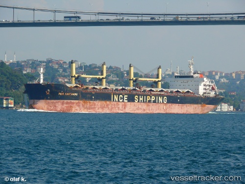
Vessel Ince Kastamonu IMO: 9456458, MMSI: 271040405 Bulk Carrier
UTC, 22.23198, 91.69886, course: 356, speed: 8
UTC, 22.28792, 91.70685, course: 123, speed: 3.8
2026-01-16 16:20:58 UTC, 22.28595, 91.71112, course: 175, speed: 0.3
Live AIS position:
UTC. Near Chittagong),
updated 2026-01-16 16:20:58 UTC.
Find the position of the vessel Ince Kastamonu on the map. The latter are known coordinates and path.
marine traffic ship tracker show on live map
The current position of vessel Ince Kastamonu is 22.28595 lat / 91.71112 lng. Updated: 2026-01-16 16:20:58 UTCCurrently sailing under the flag of Turkey
Ince Kastamonu built in 2010 year
Deadweight:
56925 tDetails:
Last coordinates of the vessel:
UTC, 22.00360, 91.81630, course: 0, speed: 11.2UTC, 22.23198, 91.69886, course: 356, speed: 8
UTC, 22.28792, 91.70685, course: 123, speed: 3.8
2026-01-16 16:20:58 UTC, 22.28595, 91.71112, course: 175, speed: 0.3