 vesseltracker.com
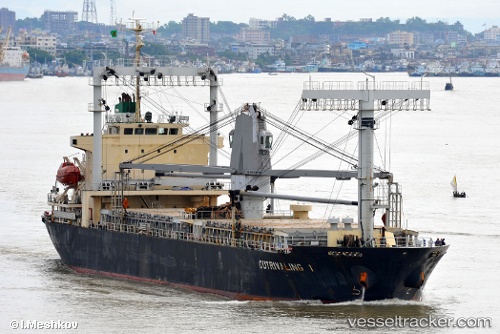
Vessel Mariwit IMO: 9459448, MMSI: 351347000 General Cargo Ship
UTC, 15.27500, 119.73500, course: -1, speed: 11
UTC, 14.76098, 119.80851, course: 168, speed: 11.2
2026-01-17 03:01:22 UTC, 14.61333, 119.83333, course: -1, speed: 11
Live AIS position:
UTC. 22 nm W of Subic Bay),
updated 2026-01-17 03:01:22 UTC.
Find the position of the vessel Mariwit on the map. The latter are known coordinates and path.
marine traffic ship tracker show on live map
The current position of vessel Mariwit is 14.61333 lat / 119.83333 lng. Updated: 2026-01-17 03:01:22 UTCCurrently sailing under the flag of Panama
Mariwit built in 2009 year
Deadweight:
11500 tDetails:
Last coordinates of the vessel:
UTC, 15.48282, 119.70528, course: 172, speed: 11UTC, 15.27500, 119.73500, course: -1, speed: 11
UTC, 14.76098, 119.80851, course: 168, speed: 11.2
2026-01-17 03:01:22 UTC, 14.61333, 119.83333, course: -1, speed: 11