 vesseltracker.com
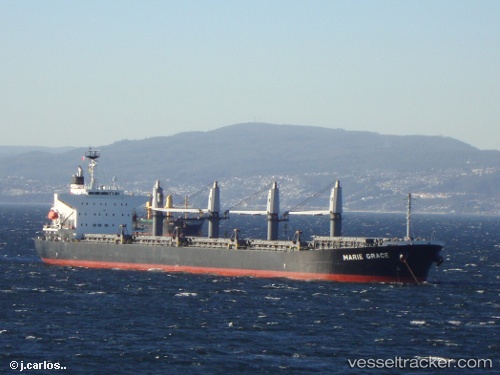
Vessel Marie Grace IMO: 9460332, MMSI: 636014046 Bulk Carrier
UTC, 29.64367, -17.38722, course: 46, speed: 8.1
UTC, 29.75683, -17.23915, course: 48, speed: 8.6
2026-01-18 18:07:15 UTC, 29.75683, -17.23915, course: 48, speed: 8.6
Live AIS position:
UTC. 69 nm NE of Roque De Los Muchachos),
updated 2026-01-18 18:07:15 UTC.
Find the position of the vessel Marie Grace on the map. The latter are known coordinates and path.
marine traffic ship tracker show on live map
The current position of vessel Marie Grace is 29.75683 lat / -17.23915 lng. Updated: 2026-01-18 18:07:15 UTCDetails:
Last coordinates of the vessel:
UTC, 29.57047, -17.48123, course: 46, speed: 7.9UTC, 29.64367, -17.38722, course: 46, speed: 8.1
UTC, 29.75683, -17.23915, course: 48, speed: 8.6
2026-01-18 18:07:15 UTC, 29.75683, -17.23915, course: 48, speed: 8.6