 vesseltracker.com
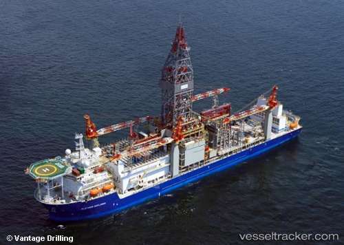
Vessel Platinum Explorer IMO: 9463516, MMSI: 311021200 Drilling Ship
UTC, 5.15976, 115.18512, course: 326, speed: 0
UTC, 5.15833, 115.18500, course: -1, speed: 0
2026-01-15 09:26:47 UTC, 5.15913, 115.18501, course: 355, speed: 0
Live AIS position:
UTC. Near LABUAN),
updated 2026-01-15 09:26:47 UTC.
Find the position of the vessel Platinum Explorer on the map. The latter are known coordinates and path.
marine traffic ship tracker show on live map
The current position of vessel Platinum Explorer is 5.15913 lat / 115.18501 lng. Updated: 2026-01-15 09:26:47 UTCDetails:
Last coordinates of the vessel:
UTC, 5.16013, 115.18518, course: 274, speed: 0UTC, 5.15976, 115.18512, course: 326, speed: 0
UTC, 5.15833, 115.18500, course: -1, speed: 0
2026-01-15 09:26:47 UTC, 5.15913, 115.18501, course: 355, speed: 0