 vesseltracker.com
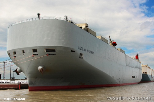
Vessel Aegean Highway IMO: 9464388, MMSI: 432666000 Vehicles Carrier
UTC, 26.59202, -152.87520, course: 92, speed: 16.7
UTC, 26.58970, -152.55185, course: 92, speed: 17.1
2026-01-19 01:58:06 UTC, 26.57080, -152.04518, course: 92, speed: 17.1
Live AIS position:
UTC. 118 nm SE of Vega de San Mateo),
updated 2026-01-19 01:58:06 UTC.
Find the position of the vessel Aegean Highway on the map. The latter are known coordinates and path.
marine traffic ship tracker show on live map
The current position of vessel Aegean Highway is 26.57080 lat / -152.04518 lng. Updated: 2026-01-19 01:58:06 UTCCurrently sailing under the flag of Japan
Aegean Highway built in 2008 year
Deadweight:
18867 tDetails:
Last coordinates of the vessel:
UTC, 26.59250, -152.93993, course: 91, speed: 16.2UTC, 26.59202, -152.87520, course: 92, speed: 16.7
UTC, 26.58970, -152.55185, course: 92, speed: 17.1
2026-01-19 01:58:06 UTC, 26.57080, -152.04518, course: 92, speed: 17.1