 vesseltracker.com
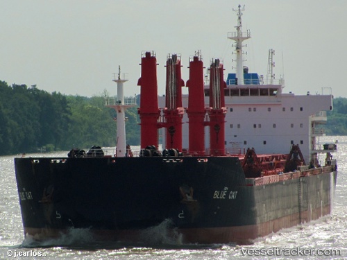
Vessel PANGEO IMO: 9467873, MMSI: 636016500 Bulk Carrier
UTC, 14.06757, 52.10683, course: 67, speed: 11.1
UTC, 14.07667, 52.13455, course: 69, speed: 11.2
2026-01-16 16:11:14 UTC, 14.16964, 52.43706, course: 72, speed: 11
Live AIS position:
UTC. 34 nm NE of Gross Koris),
updated 2026-01-16 16:11:14 UTC.
Find the position of the vessel PANGEO on the map. The latter are known coordinates and path.
marine traffic ship tracker show on live map
The current position of vessel PANGEO is 14.16964 lat / 52.43706 lng. Updated: 2026-01-16 16:11:14 UTCCurrently sailing under the flag of Liberia
PANGEO built in 2009 year
Deadweight:
57000 tDetails:
Last coordinates of the vessel:
UTC, 13.94618, 51.72232, course: 68, speed: 10.9UTC, 14.06757, 52.10683, course: 67, speed: 11.1
UTC, 14.07667, 52.13455, course: 69, speed: 11.2
2026-01-16 16:11:14 UTC, 14.16964, 52.43706, course: 72, speed: 11