 vesseltracker.com
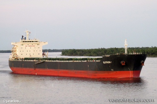
Vessel Glyfada I IMO: 9473145, MMSI: 248122000 Bulk Carrier
UTC, -37.83667, 67.14667, course: -1, speed: 8
UTC, -37.81654, 67.29650, course: 80, speed: 8.9
2026-01-18 16:32:36 UTC, -37.76546, 67.65852, course: 79, speed: 8.9
Live AIS position:
UTC. Open sea (no nearby ports in database)),
updated 2026-01-18 16:32:36 UTC.
Find the position of the vessel Glyfada I on the map. The latter are known coordinates and path.
marine traffic ship tracker show on live map
The current position of vessel Glyfada I is -37.76546 lat / 67.65852 lng. Updated: 2026-01-18 16:32:36 UTCCurrently sailing under the flag of Malta
Glyfada I built in 2009 year
Deadweight:
75639 tDetails:
Last coordinates of the vessel:
UTC, -37.86172, 66.95789, course: 88, speed: 8.6UTC, -37.83667, 67.14667, course: -1, speed: 8
UTC, -37.81654, 67.29650, course: 80, speed: 8.9
2026-01-18 16:32:36 UTC, -37.76546, 67.65852, course: 79, speed: 8.9