 vesseltracker.com
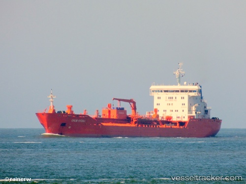
Vessel Chem Hydra IMO: 9486180, MMSI: 636017991 Chemical Oil Products Tanker
UTC, 23.26167, -97.21833, course: -1, speed: 9
UTC, 23.29833, -97.19667, course: -1, speed: 9
2026-01-17 02:14:21 UTC, 23.55613, -97.04169, course: 29, speed: 10.2
Live AIS position:
UTC. 66 nm E of Soto la Marina),
updated 2026-01-17 02:14:21 UTC.
Find the position of the vessel Chem Hydra on the map. The latter are known coordinates and path.
marine traffic ship tracker show on live map
The current position of vessel Chem Hydra is 23.55613 lat / -97.04169 lng. Updated: 2026-01-17 02:14:21 UTCCurrently sailing under the flag of Liberia
Chem Hydra built in 2009 year
Deadweight:
17055 tDetails:
Last coordinates of the vessel:
UTC, 22.85631, -97.45489, course: 29, speed: 9.9UTC, 23.26167, -97.21833, course: -1, speed: 9
UTC, 23.29833, -97.19667, course: -1, speed: 9
2026-01-17 02:14:21 UTC, 23.55613, -97.04169, course: 29, speed: 10.2