 vesseltracker.com
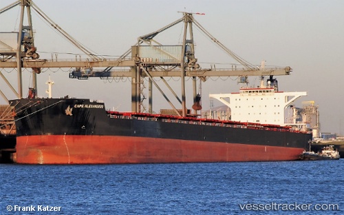
Vessel Cape Alexandros IMO: 9489302, MMSI: 636014481 Bulk Carrier
UTC, 37.97920, 121.47477, course: 20, speed: 0
UTC, 37.97948, 121.47412, course: 27, speed: 0.1
2026-01-18 15:54:47 UTC, 37.97945, 121.47390, course: 28, speed: 0.1
Live AIS position:
UTC. 26 nm N of Yantai),
updated 2026-01-18 15:54:47 UTC.
Find the position of the vessel Cape Alexandros on the map. The latter are known coordinates and path.
marine traffic ship tracker show on live map
The current position of vessel Cape Alexandros is 37.97945 lat / 121.47390 lng. Updated: 2026-01-18 15:54:47 UTCCurrently sailing under the flag of Liberia
Cape Alexandros built in 2010 year
Deadweight:
179166 tDetails:
Last coordinates of the vessel:
UTC, 37.97905, 121.47602, course: 1, speed: 0UTC, 37.97920, 121.47477, course: 20, speed: 0
UTC, 37.97948, 121.47412, course: 27, speed: 0.1
2026-01-18 15:54:47 UTC, 37.97945, 121.47390, course: 28, speed: 0.1