 vesseltracker.com
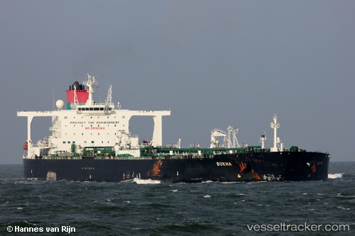
Vessel Bukha IMO: 9500936, MMSI: 538004651 Crude Oil Tanker
UTC, 14.35667, 67.98667, course: -1, speed: 12
UTC, 14.05188, 68.24723, course: 142, speed: 12.4
2026-01-18 02:42:18 UTC, 13.88333, 68.38833, course: -1, speed: 12
Live AIS position:
UTC. 238 nm N of Tinaquillo),
updated 2026-01-18 02:42:18 UTC.
Find the position of the vessel Bukha on the map. The latter are known coordinates and path.
marine traffic ship tracker show on live map
The current position of vessel Bukha is 13.88333 lat / 68.38833 lng. Updated: 2026-01-18 02:42:18 UTCDetails:
Last coordinates of the vessel:
UTC, 14.46890, 67.89323, course: 142, speed: 12.3UTC, 14.35667, 67.98667, course: -1, speed: 12
UTC, 14.05188, 68.24723, course: 142, speed: 12.4
2026-01-18 02:42:18 UTC, 13.88333, 68.38833, course: -1, speed: 12