 vesseltracker.com
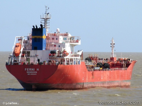
Vessel Ferni H IMO: 9502441, MMSI: 636014263 Chemical Oil Products Tanker
UTC, -39.21280, -59.63293, course: 25, speed: 11.6
UTC, -39.27667, -59.33333, course: -1, speed: 10
2026-01-19 11:37:18 UTC, -39.12429, -59.03124, course: 58, speed: 11.3
Live AIS position:
UTC. 36 nm SW of Quequen),
updated 2026-01-19 11:37:18 UTC.
Find the position of the vessel Ferni H on the map. The latter are known coordinates and path.
marine traffic ship tracker show on live map
The current position of vessel Ferni H is -39.12429 lat / -59.03124 lng. Updated: 2026-01-19 11:37:18 UTCDetails:
Last coordinates of the vessel:
UTC, -39.29167, -59.74333, course: -1, speed: 11UTC, -39.21280, -59.63293, course: 25, speed: 11.6
UTC, -39.27667, -59.33333, course: -1, speed: 10
2026-01-19 11:37:18 UTC, -39.12429, -59.03124, course: 58, speed: 11.3