 vesseltracker.com
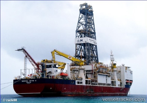
Vessel Fatih IMO: 9503770, MMSI: 271046008 Drilling Ship
UTC, 42.83270, 31.19244, course: 169, speed: 0.1
UTC, 42.83268, 31.19243, course: 170, speed: 0.1
2026-01-30 03:25:12 UTC, 42.83268, 31.19246, course: 169, speed: 0
Live AIS position:
UTC. 83 nm NW of Bartin),
updated 2026-01-30 03:25:12 UTC.
Find the position of the vessel Fatih on the map. The latter are known coordinates and path.
marine traffic ship tracker show on live map
The current position of vessel Fatih is 42.83268 lat / 31.19246 lng. Updated: 2026-01-30 03:25:12 UTCCurrently sailing under the flag of Turkey
Fatih built in 2011 year
Deadweight:
34256 tDetails:
Last coordinates of the vessel:
UTC, 42.83268, 31.19244, course: 169, speed: 0UTC, 42.83270, 31.19244, course: 169, speed: 0.1
UTC, 42.83268, 31.19243, course: 170, speed: 0.1
2026-01-30 03:25:12 UTC, 42.83268, 31.19246, course: 169, speed: 0