 vesseltracker.com
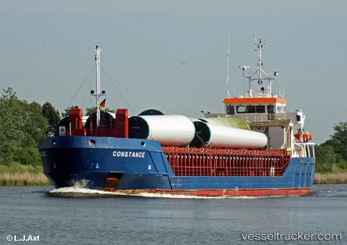
Vessel Constance IMO: 9505338, MMSI: 236622000 Multi Purpose Carrier
UTC, 40.67500, -10.11667, course: -1, speed: 10
UTC, 40.11667, -10.12833, course: -1, speed: 10
2026-01-14 23:02:47 UTC, 40.11667, -10.12833, course: -1, speed: 10
Live AIS position:
UTC. 57 nm W of Figuera Da Foz),
updated 2026-01-14 23:02:47 UTC.
Find the position of the vessel Constance on the map. The latter are known coordinates and path.
marine traffic ship tracker show on live map
The current position of vessel Constance is 40.11667 lat / -10.12833 lng. Updated: 2026-01-14 23:02:47 UTCCurrently sailing under the flag of Gibraltar
Constance built in 2011 year
Deadweight:
3196 tDetails:
Last coordinates of the vessel:
UTC, 40.83167, -10.12000, course: -1, speed: 10UTC, 40.67500, -10.11667, course: -1, speed: 10
UTC, 40.11667, -10.12833, course: -1, speed: 10
2026-01-14 23:02:47 UTC, 40.11667, -10.12833, course: -1, speed: 10