 vesseltracker.com
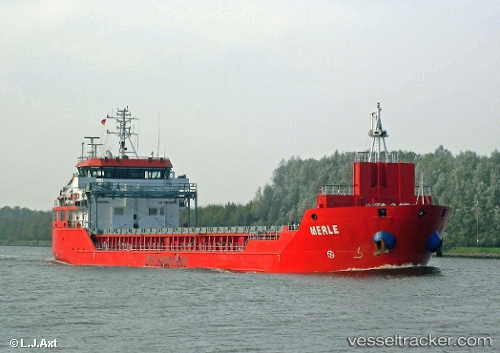
Vessel Erle IMO: 9506576, MMSI: 351750000 Multi Purpose Carrier
UTC, 42.94136, 9.67516, course: 343, speed: 8.1
UTC, 43.04333, 9.63333, course: -1, speed: 7
2026-01-16 15:45:11 UTC, 43.14833, 9.58167, course: -1, speed: 7
Live AIS position:
UTC. 13 nm NW of Capraia),
updated 2026-01-16 15:45:11 UTC.
Find the position of the vessel Erle on the map. The latter are known coordinates and path.
marine traffic ship tracker show on live map
The current position of vessel Erle is 43.14833 lat / 9.58167 lng. Updated: 2026-01-16 15:45:11 UTCCurrently sailing under the flag of Panama
Erle built in 2011 year
Deadweight:
4690 tDetails:
Last coordinates of the vessel:
UTC, 42.86333, 9.70333, course: -1, speed: 7UTC, 42.94136, 9.67516, course: 343, speed: 8.1
UTC, 43.04333, 9.63333, course: -1, speed: 7
2026-01-16 15:45:11 UTC, 43.14833, 9.58167, course: -1, speed: 7