 vesseltracker.com
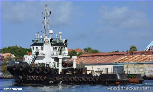
Vessel Sentry IMO: 9507946, MMSI: 377193000 Tug
UTC, 18.44667, -66.08833, course: -1, speed: 0
UTC, 18.44667, -66.08833, course: -1, speed: 0
2026-01-16 01:29:16 UTC, 18.44730, -66.08966, course: 29, speed: 0
Live AIS position:
UTC. Near Puerta de Tierra),
updated 2026-01-16 01:29:16 UTC.
Find the position of the vessel Sentry on the map. The latter are known coordinates and path.
marine traffic ship tracker show on live map
The current position of vessel Sentry is 18.44730 lat / -66.08966 lng. Updated: 2026-01-16 01:29:16 UTCCurrently sailing under the flag of St Vincent Grenadines
Details:
Last coordinates of the vessel:
UTC, 18.44667, -66.08833, course: -1, speed: 0UTC, 18.44667, -66.08833, course: -1, speed: 0
UTC, 18.44667, -66.08833, course: -1, speed: 0
2026-01-16 01:29:16 UTC, 18.44730, -66.08966, course: 29, speed: 0