 vesseltracker.com
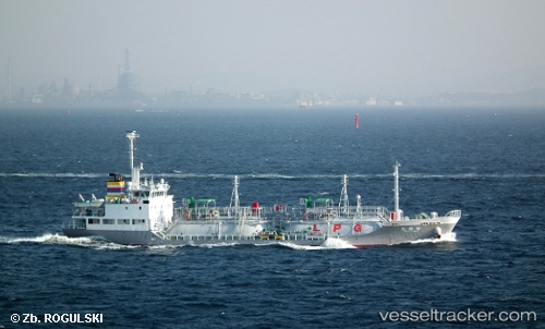
Vessel Shoryu Maru IMO: 9512836, MMSI: 431000689 Lpg Tanker
UTC, 34.19429, 137.02443, course: 245, speed: 12.2
UTC, 34.13833, 136.93500, course: -1, speed: 12
2026-01-18 19:36:22 UTC, 33.86833, 136.49834, course: -1, speed: 13
Live AIS position:
UTC. 29 nm SW of HAMAJIMA),
updated 2026-01-18 19:36:22 UTC.
Find the position of the vessel Shoryu Maru on the map. The latter are known coordinates and path.
marine traffic ship tracker show on live map
The current position of vessel Shoryu Maru is 33.86833 lat / 136.49834 lng. Updated: 2026-01-18 19:36:22 UTCCurrently sailing under the flag of Japan
Shoryu Maru built in 2008 year
Deadweight:
986 tDetails:
Last coordinates of the vessel:
UTC, 34.28595, 137.29523, course: 245, speed: 12.1UTC, 34.19429, 137.02443, course: 245, speed: 12.2
UTC, 34.13833, 136.93500, course: -1, speed: 12
2026-01-18 19:36:22 UTC, 33.86833, 136.49834, course: -1, speed: 13