 vesseltracker.com
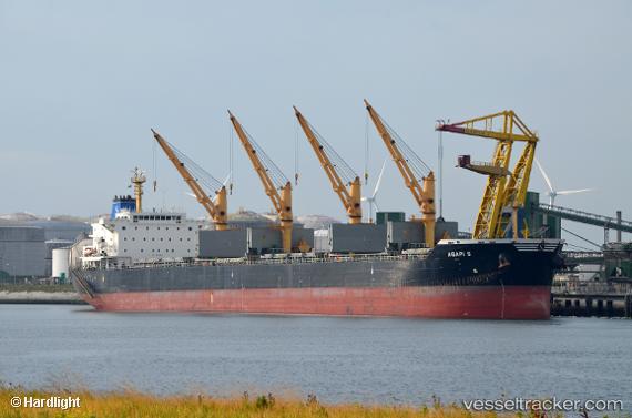
Vessel Agapi S IMO: 9514822, MMSI: 636015430 Bulk Carrier
UTC, 31.49031, 32.30652, course: 298, speed: 10
UTC, 31.74718, 31.98261, course: 309, speed: 10.9
2026-01-16 21:19:45 UTC, 31.93212, 31.67151, course: 296, speed: 10.5
Live AIS position:
UTC. Near Bnei Darom),
updated 2026-01-16 21:19:45 UTC.
Find the position of the vessel Agapi S on the map. The latter are known coordinates and path.
marine traffic ship tracker show on live map
The current position of vessel Agapi S is 31.93212 lat / 31.67151 lng. Updated: 2026-01-16 21:19:45 UTCDetails:
Last coordinates of the vessel:
UTC, 31.36719, 32.31570, course: 331, speed: 0UTC, 31.49031, 32.30652, course: 298, speed: 10
UTC, 31.74718, 31.98261, course: 309, speed: 10.9
2026-01-16 21:19:45 UTC, 31.93212, 31.67151, course: 296, speed: 10.5