 vesseltracker.com
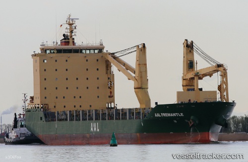
Vessel AAL FREMANTLE IMO: 9521095, MMSI: 210415000 General Cargo Ship
UTC, 1.26729, 104.03781, course: 259, speed: 11.3
UTC, 1.25693, 103.77237, course: 305, speed: 4.2
2026-01-17 09:40:16 UTC, 1.30143, 103.72413, course: 115, speed: 0.5
Live AIS position:
UTC. Near Pulau Ayer Chawan),
updated 2026-01-17 09:40:16 UTC.
Find the position of the vessel AAL FREMANTLE on the map. The latter are known coordinates and path.
marine traffic ship tracker show on live map
The current position of vessel AAL FREMANTLE is 1.30143 lat / 103.72413 lng. Updated: 2026-01-17 09:40:16 UTCCurrently sailing under the flag of Cyprus
AAL FREMANTLE built in 2011 year
Deadweight:
18762 tDetails:
Last coordinates of the vessel:
UTC, 1.29526, 104.22907, course: 261, speed: 9UTC, 1.26729, 104.03781, course: 259, speed: 11.3
UTC, 1.25693, 103.77237, course: 305, speed: 4.2
2026-01-17 09:40:16 UTC, 1.30143, 103.72413, course: 115, speed: 0.5