 vesseltracker.com
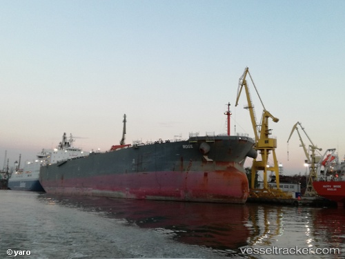
Vessel Nordrose IMO: 9521435, MMSI: 255806155 Crude Oil Tanker
UTC, 19.55718, -91.65125, course: 1, speed: 1.9
UTC, 19.57840, -91.65308, course: 7, speed: 0.3
2026-01-18 22:27:48 UTC, 19.57983, -91.65318, course: 8, speed: 0.5
Live AIS position:
UTC. 11 nm S of Takuntah),
updated 2026-01-18 22:27:48 UTC.
Find the position of the vessel Nordrose on the map. The latter are known coordinates and path.
marine traffic ship tracker show on live map
The current position of vessel Nordrose is 19.57983 lat / -91.65318 lng. Updated: 2026-01-18 22:27:48 UTCDetails:
Last coordinates of the vessel:
UTC, 19.49711, -91.65380, course: 10, speed: 3.4UTC, 19.55718, -91.65125, course: 1, speed: 1.9
UTC, 19.57840, -91.65308, course: 7, speed: 0.3
2026-01-18 22:27:48 UTC, 19.57983, -91.65318, course: 8, speed: 0.5