 vesseltracker.com
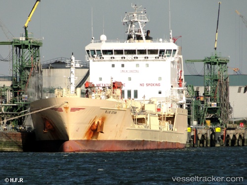
Vessel Blue Star IMO: 9527764, MMSI: 215691000 Chemical Oil Products Tanker
UTC, 40.768, 29.5456, course: 339, speed: 0
UTC, 40.768, 29.5456, course: 339, speed: 0.1
2026-01-17 15:38:52 UTC, 40.7679, 29.5456, course: 339, speed: 0
Live AIS position:
UTC. Near Yilport),
updated 2026-01-17 15:38:52 UTC.
Find the position of the vessel Blue Star on the map. The latter are known coordinates and path.
marine traffic ship tracker show on live map
The current position of vessel Blue Star is 40.7679 lat / 29.5456 lng. Updated: 2026-01-17 15:38:52 UTCDetails:
Last coordinates of the vessel:
UTC, 40.768, 29.5456, course: 339, speed: 0.1UTC, 40.768, 29.5456, course: 339, speed: 0
UTC, 40.768, 29.5456, course: 339, speed: 0.1
2026-01-17 15:38:52 UTC, 40.7679, 29.5456, course: 339, speed: 0