 vesseltracker.com
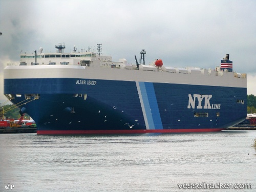
Vessel Altair Leader IMO: 9539171, MMSI: 432817000 Vehicles Carrier
UTC, 18.46679, -156.16833, course: 270, speed: 12.3
UTC, 18.47345, -156.40994, course: 269, speed: 11.9
2026-01-17 10:50:04 UTC, 18.47559, -156.51707, course: 271, speed: 11.8
Live AIS position:
UTC. 70 nm SW of Captain Cook),
updated 2026-01-17 10:50:04 UTC.
Find the position of the vessel Altair Leader on the map. The latter are known coordinates and path.
marine traffic ship tracker show on live map
The current position of vessel Altair Leader is 18.47559 lat / -156.51707 lng. Updated: 2026-01-17 10:50:04 UTCDetails:
Last coordinates of the vessel:
UTC, 18.47790, -155.77356, course: 270, speed: 12.4UTC, 18.46679, -156.16833, course: 270, speed: 12.3
UTC, 18.47345, -156.40994, course: 269, speed: 11.9
2026-01-17 10:50:04 UTC, 18.47559, -156.51707, course: 271, speed: 11.8