 vesseltracker.com
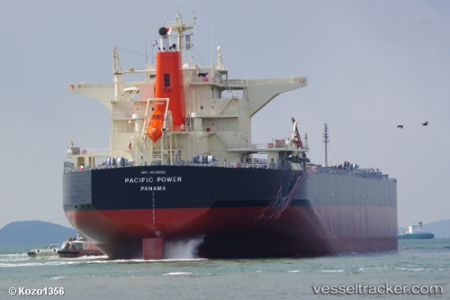
Vessel Pacific Power IMO: 9539262, MMSI: 370678000 Bulk Carrier
UTC, 2.30868, 144.34602, course: 163, speed: 12.7
UTC, 2.29910, 144.34862, course: 163, speed: 12.7
2026-01-17 17:19:25 UTC, 1.91747, 144.43575, course: 167, speed: 12.5
Live AIS position:
UTC. 295 nm NW of Lombrum),
updated 2026-01-17 17:19:25 UTC.
Find the position of the vessel Pacific Power on the map. The latter are known coordinates and path.
marine traffic ship tracker show on live map
The current position of vessel Pacific Power is 1.91747 lat / 144.43575 lng. Updated: 2026-01-17 17:19:25 UTCDetails:
Last coordinates of the vessel:
UTC, 2.65599, 144.25751, course: 163, speed: 12.5UTC, 2.30868, 144.34602, course: 163, speed: 12.7
UTC, 2.29910, 144.34862, course: 163, speed: 12.7
2026-01-17 17:19:25 UTC, 1.91747, 144.43575, course: 167, speed: 12.5