 vesseltracker.com
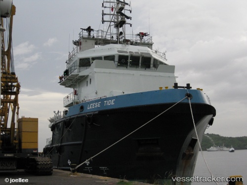
Vessel Leese Tide IMO: 9539626, MMSI: 576207000 Offshore Tug Supply Ship
UTC, 28.44500, 49.65167, course: -1, speed: 0
UTC, 28.44500, 49.65333, course: -1, speed: 0
2026-01-19 20:25:09 UTC, 28.44500, 49.65167, course: -1, speed: 0
Live AIS position:
UTC. 37 nm S of Soroosh (Cyrus) Terminal),
updated 2026-01-19 20:25:09 UTC.
Find the position of the vessel Leese Tide on the map. The latter are known coordinates and path.
marine traffic ship tracker show on live map
The current position of vessel Leese Tide is 28.44500 lat / 49.65167 lng. Updated: 2026-01-19 20:25:09 UTCDetails:
Last coordinates of the vessel:
UTC, 28.44500, 49.65167, course: -1, speed: 0UTC, 28.44500, 49.65167, course: -1, speed: 0
UTC, 28.44500, 49.65333, course: -1, speed: 0
2026-01-19 20:25:09 UTC, 28.44500, 49.65167, course: -1, speed: 0