 vesseltracker.com
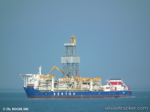
Vessel Kanuni IMO: 9541203, MMSI: 271047822 Drilling Ship
UTC, 41.59000, 32.08366, course: 342, speed: 0
UTC, 41.58833, 32.08333, course: -1, speed: 0
2026-01-17 12:59:05 UTC, 41.58833, 32.08333, course: -1, speed: 0
Live AIS position:
UTC. Near Bartin),
updated 2026-01-17 12:59:05 UTC.
Find the position of the vessel Kanuni on the map. The latter are known coordinates and path.
marine traffic ship tracker show on live map
The current position of vessel Kanuni is 41.58833 lat / 32.08333 lng. Updated: 2026-01-17 12:59:05 UTCCurrently sailing under the flag of Turkey
Kanuni built in 2012 year
Deadweight:
61537 tDetails:
Last coordinates of the vessel:
UTC, 41.59000, 32.08366, course: 342, speed: 0UTC, 41.59000, 32.08366, course: 342, speed: 0
UTC, 41.58833, 32.08333, course: -1, speed: 0
2026-01-17 12:59:05 UTC, 41.58833, 32.08333, course: -1, speed: 0