 vesseltracker.com
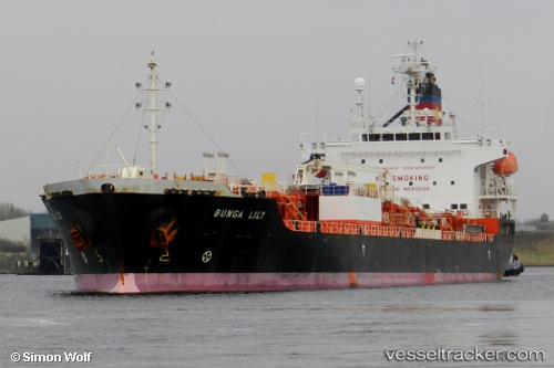
Vessel Bunga Lily IMO: 9542178, MMSI: 355093000 Chemical Oil Products Tanker
UTC, 1.75915, -31.40650, course: 275, speed: 13.9
UTC, 1.78018, -31.60967, course: 276, speed: 13.8
2026-01-16 16:28:13 UTC, 1.78185, -31.62375, course: 274, speed: 13.8
Live AIS position:
UTC. 340 nm N of Fernando De Noronha),
updated 2026-01-16 16:28:13 UTC.
Find the position of the vessel Bunga Lily on the map. The latter are known coordinates and path.
marine traffic ship tracker show on live map
The current position of vessel Bunga Lily is 1.78185 lat / -31.62375 lng. Updated: 2026-01-16 16:28:13 UTCCurrently sailing under the flag of Panama
Bunga Lily built in 2011 year
Deadweight:
19991 tDetails:
Last coordinates of the vessel:
UTC, 1.73187, -31.14300, course: 275, speed: 13.9UTC, 1.75915, -31.40650, course: 275, speed: 13.9
UTC, 1.78018, -31.60967, course: 276, speed: 13.8
2026-01-16 16:28:13 UTC, 1.78185, -31.62375, course: 274, speed: 13.8