 vesseltracker.com
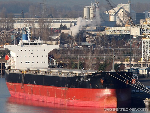
Vessel Bryant IMO: 9544700, MMSI: 538005193 Bulk Carrier
UTC, -24.10805, -46.26515, course: 72, speed: 0
UTC, -24.10767, -46.26510, course: 79, speed: 0.1
2026-01-16 03:29:09 UTC, -24.10753, -46.26515, course: 84, speed: 0
Live AIS position:
UTC. Near Guarujá),
updated 2026-01-16 03:29:09 UTC.
Find the position of the vessel Bryant on the map. The latter are known coordinates and path.
marine traffic ship tracker show on live map
The current position of vessel Bryant is -24.10753 lat / -46.26515 lng. Updated: 2026-01-16 03:29:09 UTCDetails:
Last coordinates of the vessel:
UTC, -24.10805, -46.26513, course: 72, speed: 0.1UTC, -24.10805, -46.26515, course: 72, speed: 0
UTC, -24.10767, -46.26510, course: 79, speed: 0.1
2026-01-16 03:29:09 UTC, -24.10753, -46.26515, course: 84, speed: 0