 vesseltracker.com
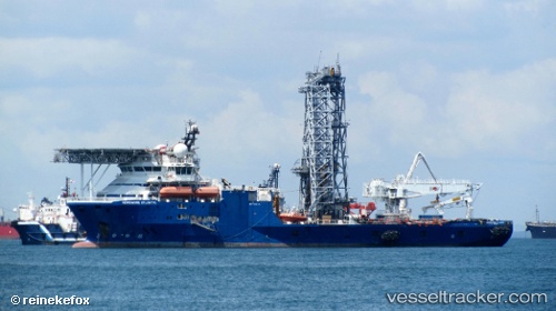
Vessel Norshore Atlantic IMO: 9545675, MMSI: 538007721 Well Stimulation Vessel
UTC, 24.27652, 120.51650, course: 198, speed: 0
UTC, 24.27652, 120.51647, course: 198, speed: 0
2026-01-18 06:58:46 UTC, 24.27649, 120.51648, course: 199, speed: 0
Live AIS position:
UTC. Near TAICHUNG),
updated 2026-01-18 06:58:46 UTC.
Find the position of the vessel Norshore Atlantic on the map. The latter are known coordinates and path.
marine traffic ship tracker show on live map
The current position of vessel Norshore Atlantic is 24.27649 lat / 120.51648 lng. Updated: 2026-01-18 06:58:46 UTCCurrently sailing under the flag of Marshall Is
Details:
Last coordinates of the vessel:
UTC, 24.27650, 120.51651, course: 198, speed: 0UTC, 24.27652, 120.51650, course: 198, speed: 0
UTC, 24.27652, 120.51647, course: 198, speed: 0
2026-01-18 06:58:46 UTC, 24.27649, 120.51648, course: 199, speed: 0