 vesseltracker.com
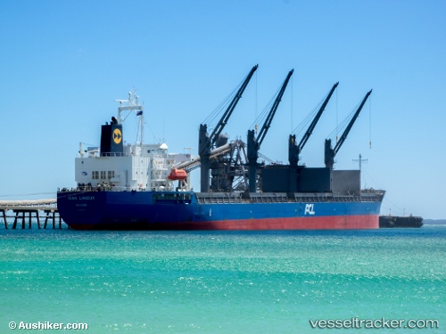
Vessel Ikan Landuk IMO: 9547166, MMSI: 563056300 Bulk Carrier
UTC, 19.08713, 72.52495, course: 327, speed: 0
UTC, 19.08936, 72.52517, course: 267, speed: 0.1
2026-01-19 05:27:15 UTC, 19.08961, 72.52470, course: 248, speed: 0
Live AIS position:
UTC. 18 nm W of Precious Cargo Customs Clearance Centre/Bandra),
updated 2026-01-19 05:27:15 UTC.
Find the position of the vessel Ikan Landuk on the map. The latter are known coordinates and path.
marine traffic ship tracker show on live map
The current position of vessel Ikan Landuk is 19.08961 lat / 72.52470 lng. Updated: 2026-01-19 05:27:15 UTCDetails:
Last coordinates of the vessel:
UTC, 19.08675, 72.52388, course: 355, speed: 0UTC, 19.08713, 72.52495, course: 327, speed: 0
UTC, 19.08936, 72.52517, course: 267, speed: 0.1
2026-01-19 05:27:15 UTC, 19.08961, 72.52470, course: 248, speed: 0