 vesseltracker.com
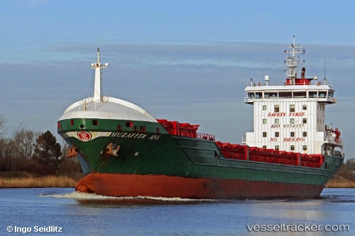
Vessel Muzafffer Ana IMO: 9554157, MMSI: 314526000 General Cargo Ship
UTC, 59.91989, 28.66461, course: 247, speed: 0.1
UTC, 59.91989, 28.66461, course: 247, speed: 0.1
2026-01-17 16:20:05 UTC, 59.91989, 28.66461, course: 247, speed: 0.1
Live AIS position:
UTC. 10 nm NE of VISTINO),
updated 2026-01-17 16:20:05 UTC.
Find the position of the vessel Muzafffer Ana on the map. The latter are known coordinates and path.
marine traffic ship tracker show on live map
The current position of vessel Muzafffer Ana is 59.91989 lat / 28.66461 lng. Updated: 2026-01-17 16:20:05 UTCCurrently sailing under the flag of Barbados
Details:
Last coordinates of the vessel:
UTC, 59.91989, 28.66461, course: 247, speed: 0.1UTC, 59.91989, 28.66461, course: 247, speed: 0.1
UTC, 59.91989, 28.66461, course: 247, speed: 0.1
2026-01-17 16:20:05 UTC, 59.91989, 28.66461, course: 247, speed: 0.1