 vesseltracker.com
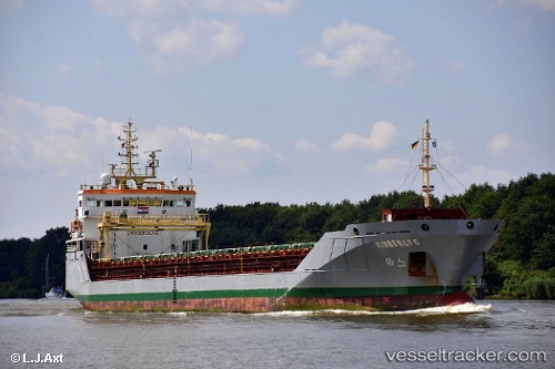
Vessel KIMBERLY C IMO: 9558050, MMSI: 255806518 General Cargo Ship
UTC, 36.40167, 20.30667, course: -1, speed: 9
UTC, 36.40667, 20.18167, course: -1, speed: 10
2026-01-17 12:55:06 UTC, 36.41000, 19.86833, course: -1, speed: 10
Live AIS position:
UTC. 92 nm W of Navarino Bay),
updated 2026-01-17 12:55:06 UTC.
Find the position of the vessel KIMBERLY C on the map. The latter are known coordinates and path.
marine traffic ship tracker show on live map
The current position of vessel KIMBERLY C is 36.41000 lat / 19.86833 lng. Updated: 2026-01-17 12:55:06 UTCCurrently sailing under the flag of Portugal (MAR)
KIMBERLY C built in 2011 year
Deadweight:
6806 tDetails:
Last coordinates of the vessel:
UTC, 36.39832, 20.48825, course: 270, speed: 10.1UTC, 36.40167, 20.30667, course: -1, speed: 9
UTC, 36.40667, 20.18167, course: -1, speed: 10
2026-01-17 12:55:06 UTC, 36.41000, 19.86833, course: -1, speed: 10