 vesseltracker.com
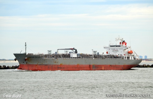
Vessel STOLT DUGONG IMO: 9565699, MMSI: 636021909 Chemical/Oil Products Tanker
UTC, 25.71712, 54.92917, course: 265, speed: 9.4
UTC, 25.72945, 54.84974, course: 132, speed: 5.7
2026-01-16 07:43:18 UTC, 25.69415, 54.87531, course: 206, speed: 1.7
Live AIS position:
UTC. 13 nm SW of ABU MUSA),
updated 2026-01-16 07:43:18 UTC.
Find the position of the vessel STOLT DUGONG on the map. The latter are known coordinates and path.
marine traffic ship tracker show on live map
The current position of vessel STOLT DUGONG is 25.69415 lat / 54.87531 lng. Updated: 2026-01-16 07:43:18 UTCCurrently sailing under the flag of Liberia
STOLT DUGONG built in 2012 year
Deadweight:
33591 tDetails:
Last coordinates of the vessel:
UTC, 25.70760, 54.95888, course: 15, speed: 1.6UTC, 25.71712, 54.92917, course: 265, speed: 9.4
UTC, 25.72945, 54.84974, course: 132, speed: 5.7
2026-01-16 07:43:18 UTC, 25.69415, 54.87531, course: 206, speed: 1.7