 vesseltracker.com
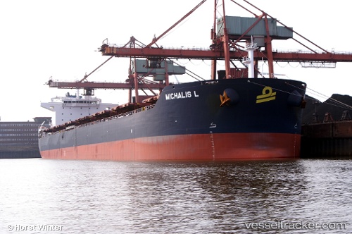
Vessel Michalis L IMO: 9565704, MMSI: 636014462 Bulk Carrier
UTC, -32.07245, 10.40162, course: 295, speed: 12.2
UTC, -31.98832, 10.17303, course: 290, speed: 11.7
2026-01-17 03:58:57 UTC, -31.90755, 9.94258, course: 293, speed: 12
Live AIS position:
UTC. 391 nm W of Koiingnaas),
updated 2026-01-17 03:58:57 UTC.
Find the position of the vessel Michalis L on the map. The latter are known coordinates and path.
marine traffic ship tracker show on live map
The current position of vessel Michalis L is -31.90755 lat / 9.94258 lng. Updated: 2026-01-17 03:58:57 UTCDetails:
Last coordinates of the vessel:
UTC, -32.15850, 10.62645, course: 290, speed: 12.5UTC, -32.07245, 10.40162, course: 295, speed: 12.2
UTC, -31.98832, 10.17303, course: 290, speed: 11.7
2026-01-17 03:58:57 UTC, -31.90755, 9.94258, course: 293, speed: 12