 vesseltracker.com
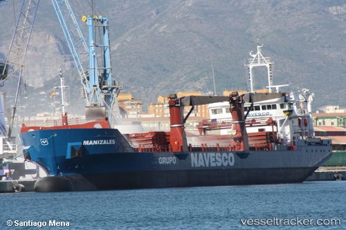
Vessel Manizales IMO: 9567257, MMSI: 352476000 General Cargo Ship
UTC, 31.85569, -79.56392, course: 188, speed: 10.1
UTC, 31.79833, -79.56833, course: -1, speed: 9
2026-01-17 14:41:55 UTC, 31.65833, -79.58333, course: -1, speed: 10
Live AIS position:
UTC. 62 nm SE of Kiawah Island),
updated 2026-01-17 14:41:55 UTC.
Find the position of the vessel Manizales on the map. The latter are known coordinates and path.
marine traffic ship tracker show on live map
The current position of vessel Manizales is 31.65833 lat / -79.58333 lng. Updated: 2026-01-17 14:41:55 UTCCurrently sailing under the flag of Panama
Manizales built in 2011 year
Deadweight:
7850 tDetails:
Last coordinates of the vessel:
UTC, 32.20456, -79.56292, course: 183, speed: 9.7UTC, 31.85569, -79.56392, course: 188, speed: 10.1
UTC, 31.79833, -79.56833, course: -1, speed: 9
2026-01-17 14:41:55 UTC, 31.65833, -79.58333, course: -1, speed: 10