 vesseltracker.com
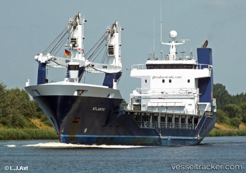
Vessel Atlantic IMO: 9573634, MMSI: 246757000 General Cargo Ship
UTC, 35.14505, 34.00882, course: 141, speed: 12.9
UTC, 35.14505, 34.00882, course: 141, speed: 12.9
2026-01-15 09:46:24 UTC, 35.14505, 34.00882, course: 141, speed: 12.9
Live AIS position:
UTC. Near Famagusta),
updated 2026-01-15 09:46:24 UTC.
Find the position of the vessel Atlantic on the map. The latter are known coordinates and path.
marine traffic ship tracker show on live map
The current position of vessel Atlantic is 35.14505 lat / 34.00882 lng. Updated: 2026-01-15 09:46:24 UTCCurrently sailing under the flag of Netherlands
Atlantic built in 2011 year
Deadweight:
3750 tDetails:
Last coordinates of the vessel:
UTC, 35.22233, 33.93242, course: 135, speed: 6.4UTC, 35.14505, 34.00882, course: 141, speed: 12.9
UTC, 35.14505, 34.00882, course: 141, speed: 12.9
2026-01-15 09:46:24 UTC, 35.14505, 34.00882, course: 141, speed: 12.9