 vesseltracker.com
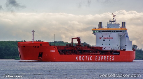
Vessel ENISEY IMO: 9585273, MMSI: 273357330 Oil Products Tanker
UTC, 64.59167, 40.72167, course: -1, speed: 52
UTC, 64.59167, 40.72167, course: -1, speed: 52
2026-01-17 01:32:24 UTC, 64.59167, 40.72167, course: -1, speed: 52
Live AIS position:
UTC. Near ARKHANGELSK),
updated 2026-01-17 01:32:24 UTC.
Find the position of the vessel ENISEY on the map. The latter are known coordinates and path.
marine traffic ship tracker show on live map
The current position of vessel ENISEY is 64.59167 lat / 40.72167 lng. Updated: 2026-01-17 01:32:24 UTCCurrently sailing under the flag of Russia
ENISEY built in 2011 year
Deadweight:
18902 tDetails:
Last coordinates of the vessel:
UTC, 64.59167, 40.72167, course: -1, speed: 52UTC, 64.59167, 40.72167, course: -1, speed: 52
UTC, 64.59167, 40.72167, course: -1, speed: 52
2026-01-17 01:32:24 UTC, 64.59167, 40.72167, course: -1, speed: 52