 vesseltracker.com
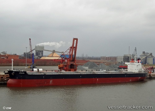
Vessel Arouzu IMO: 9589138, MMSI: 373154000 Bulk Carrier
UTC, 51.14500, 170.25500, course: -1, speed: 11
UTC, 51.14833, 170.26833, course: -1, speed: 10
2026-01-17 11:34:11 UTC, 51.17836, 170.42329, course: 72, speed: 11.4
Live AIS position:
UTC. 98 nm W of Zorawina),
updated 2026-01-17 11:34:11 UTC.
Find the position of the vessel Arouzu on the map. The latter are known coordinates and path.
marine traffic ship tracker show on live map
The current position of vessel Arouzu is 51.17836 lat / 170.42329 lng. Updated: 2026-01-17 11:34:11 UTCDetails:
Last coordinates of the vessel:
UTC, 51.08833, 169.97833, course: -1, speed: 11UTC, 51.14500, 170.25500, course: -1, speed: 11
UTC, 51.14833, 170.26833, course: -1, speed: 10
2026-01-17 11:34:11 UTC, 51.17836, 170.42329, course: 72, speed: 11.4